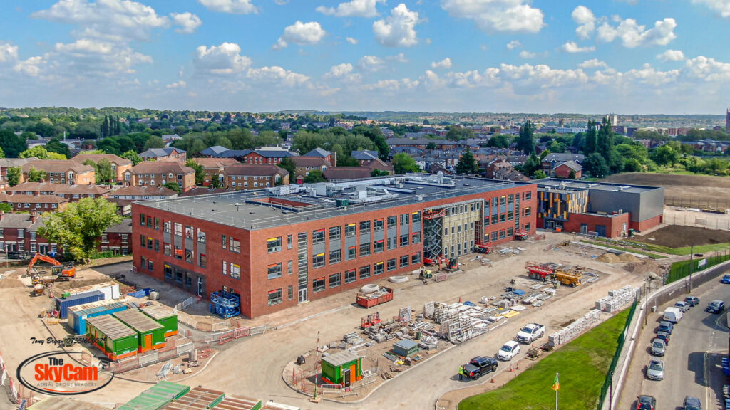
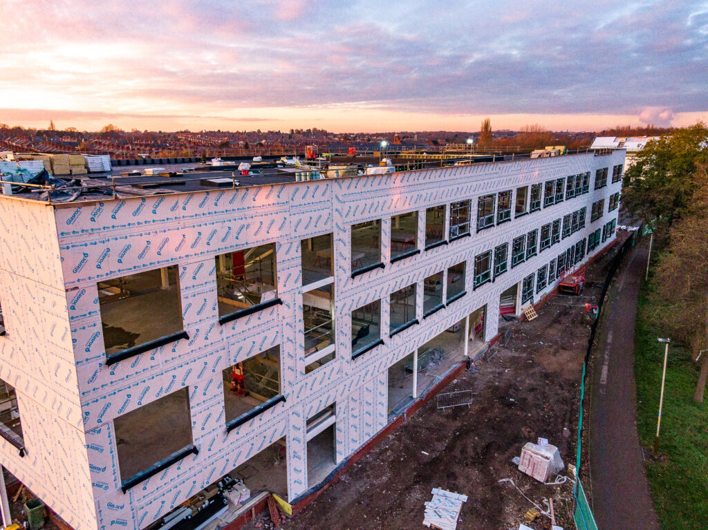
Drone Site Surveys
Aerial photography & videography surveys for construction sites and development projects
Aerial Site Surveys for Leicestershire, Staffordshire, Derbyshire & Nottinghamshire
TB Drones is a CAA approved drone operator providing commercial site surveys for home builders, developers and construction companies in the East Midlands. As an established aerial photography business, we offer a high quality, fully insured drone site survey service.
TB Drones provides Derby, Leicester, Nottingham, Stafford & Tamworth Drone Services & Aerial Photography.
Drone Site Updates & Mapping
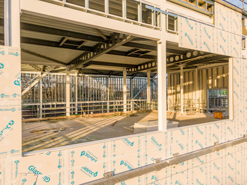
Whether you require weekly, monthly or quarterly aerial photography updates TB-Drones can help. We can provide drone site update photos or HD videos, in normal video or time-lapse format, we can also provide orthomosaic maps of your site (see below).
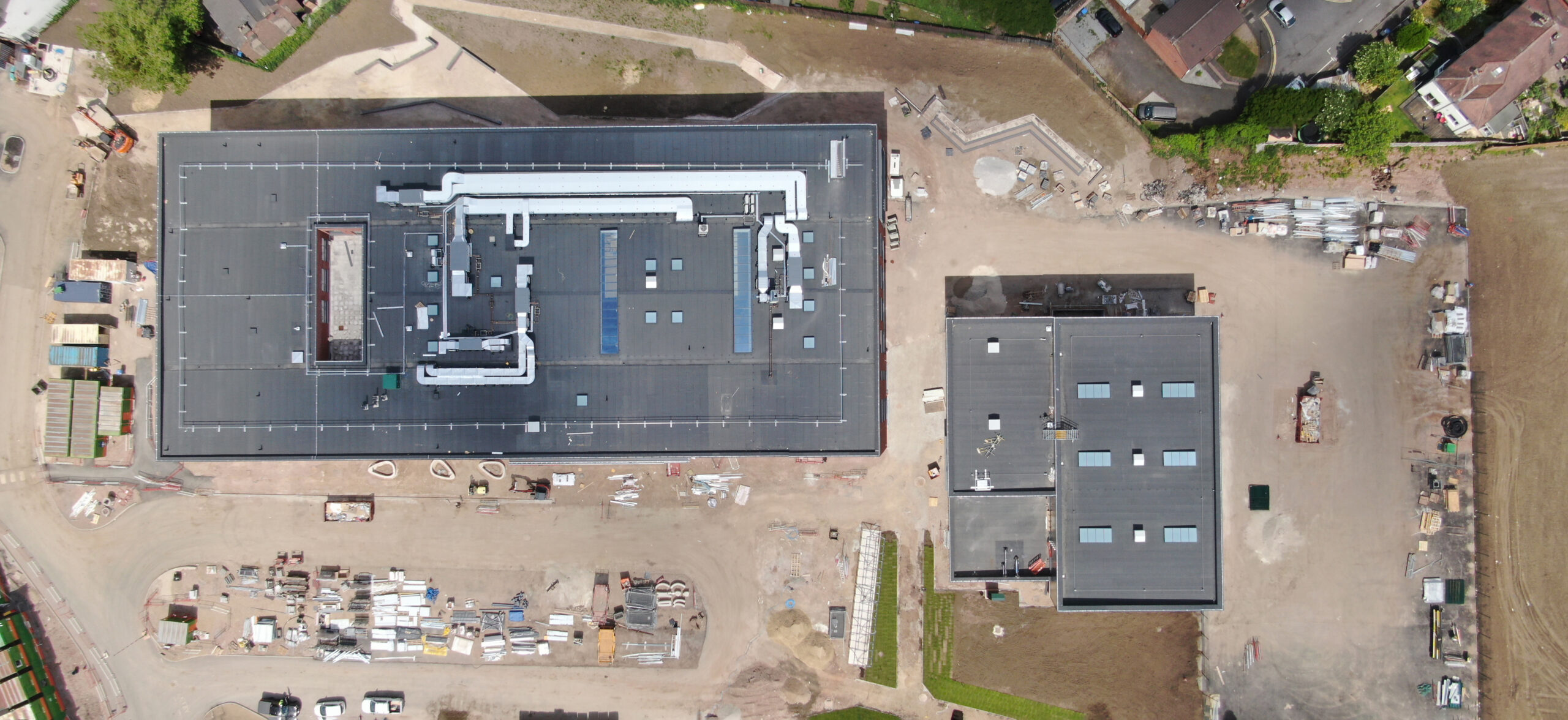
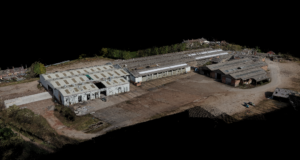
What is an Orthomosaic photo?
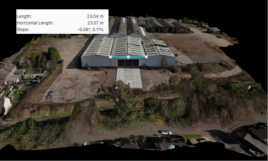
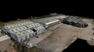
An Orthomosaic photo is a single photo made up of 100s or 1000s of single aerial photos, that are then stitched together using specialised software. The end result means a single photo with excellent detail, rather than 100s or 1000s of individuals to trawl through. Which is great for site updates, or even as a backdrop for a meeting point on site. They can also be used in conjunction with maintenance planning, you can zoom in and view the intricate details of a particular part of a roof or site. From a single photo of a complete building in one photo, you can look at the condition along with potential issues as well as access points.
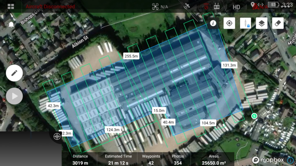
Drone mapping route of site
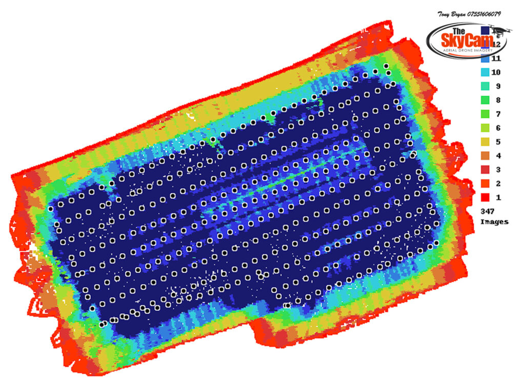
Overlay of quantity of aerial photos taken
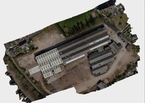
Full aerial site map in one photo
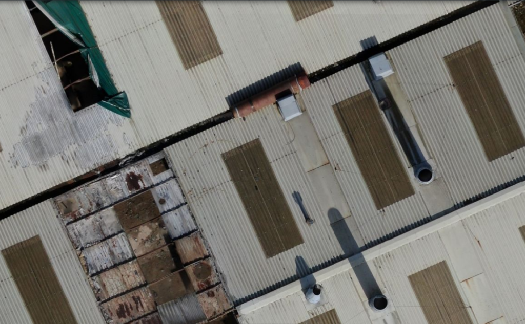
Zoomed in section of map created by drone
Relative accuracy of Drone Site Surveys
Relative accuracy will still give you a very high detailed single aerial photo of your site, enabling you to see progress from a 2d and 3d point of view in fantastic detail. However, in the relationship to its measurement, it may have some errors which you would have to discuss with the onsite team. This can be done by taking an actual measurement on-site of a known distance and comparing between the actual and the known, this way you can offer a tolerance to the customer that it will be within.
It may also have some error in the relationship as to where it sits within the whole world, it may be off in comparison to where it should actually be, in longitude, latitude, or a mixture of both.
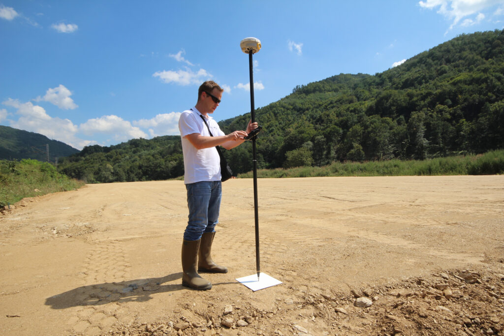
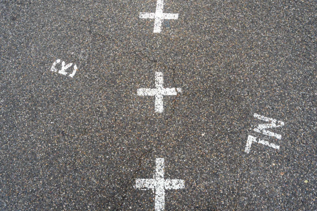
Absolute accuracy, what’s the difference?
Absolute accuracy gives you the true world position of your map in relation to the world, these are completed in the same way as a relatively accurate photograph, however, there will be a number of (GCPs:- Ground Control Points), which are GPS positions on specific markers within the photograph. By entering the GPS coordinates into the photo software, your site photo will be accurate to the real world, there will be some tolerances in there, but these can usually be discussed between the drone pilot and the site survey team. Ground Control Points would need to be supplied via a land surveyor.
What else can Drone Site mapping offer?
We can produce a 3D model of your site using our drones for you to view on your own workstation. This can be useful as a reference if planning maintenance work, (export would be in .obj format).
Creating a 3D Point Cloud with a Drone
A 3D point cloud captured by a drone enables you to insert the 3D model into cad, which will give you a fantastic aerial view of your site that can be worked with, either on its own or inserted into other cad models. (Export would be in .las format)
Our Drone Site Survey Clients
TB Drones works with developers, housebuilders, landlords, housing associations and many others. We can cover one-off site surveys through to large scale roof projects over many months or years. Check out our reviews page.
What Drones Do We Use For Site Surveys?
We use the latest drones from DJI – the leader in aerial photography. This ensures we can provide high-resolution images and 4K or 1080P HD video to track the progress of your construction site or development project. The battery life of our drones means we can survey large areas in a single flight to ensure the operation is efficient and cost-effective.
Hire TB Drones For Your Aerial Site Inspection
TB Drones are a 5* team of professional aerial photographers. All our pilots are fully qualified and experienced, so you can be safe knowing that we are a 5* team of professional aerial photographers. All our pilots are fully qualified and experienced, so you can be safe knowing that your job will be completed to the highest standard. All of the pilots have GVCs with CAA Operational Authorisation, along with the A2COC, they also have £5 Million liability insurance EC785/2004; more can be added should you need it.
Latest From The Blog
No posts
About TB Drones
TB Drones is a professional drone operator based in the Midlands, covering the areas of Derby, Leicestershire, Nottingham, Stafford, Tamworth and the surrounding regions. With years of experience in aerial photography, videography, roof surveys, and site inspections, TB Drones offers unparalleled expertise and top-notch services to its clients. Their state-of-the-art drones and cutting-edge technology allow them to capture stunning footage and images from above, delivering exceptional quality and accuracy to meet the specific needs of their clients. Whether you need drone footage for your business, real estate, construction or other purposes, TB Drones has covered you.
Contact TB Drones about an Aerial Site Survey
Get in touch today for a personalised drone site survey quote. We also provide drone roof inspections, aerial photography and drone videography. We cover Tamworth and surrounding areas such as [cities] as well the Derbyshire, Leicestershire, Staffordshire, Nottinghamshire, the East Midlands and the UK as a whole.