Imagine soaring high above the ground, capturing breathtaking images that reveal the world from a fresh, exciting perspective. This is the magic of aerial photography. In this blog post, we will delve into the power of aerial photographs, their applications, and the inspiring projects they make possible. Are you ready to explore the skies?
Short Summary
Unlock the power of aerial photography to explore landscapes, document changes and unlock potential!
Discover historic aerial photographs from 1940s to present & utilize imagery for planning/development.
Capture stunning images with camera drones, follow safety regulations & be inspired by creative projects!
The Power of Aerial Photographs

Aerial photography is an incredibly powerful tool for capturing absolutely stunning images from the sky. From historic aerial photographs that document changes in landscapes over time to modern aerial imagery used for planning and development, this art form has a wide range of applications. But it doesn’t stop there! Aerial photography collections can be used to explore areas and find specific locations, making them an invaluable resource for research and development. And with services like Air Images offering aerial photography for boundary disputes, planning, marketing, and stunning presentations, the sky is truly the limit.
Imagine the wealth of information that can be gleaned from examining aerial photographs over the years, as landscapes transform and evolve. From London’s ever-changing skyline to the growth of trees in a once-barren field, aerial images reveal the passage of time in a way that is both informative and visually captivating.
In the following sections, we’ll take a closer look at the various applications and benefits of aerial photographs.
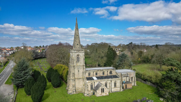
Historic Aerial Photographs
Historic aerial photographs, taken from the 1940s to the present day, offer a fascinating glimpse into the past. With thorough national coverage provided by Air Images, these photographs can be used to provide valuable evidence for legal disputes like boundary issues and planning problems. They also serve as an incredible resource for studying the changes in landscapes and urban environments over time.
In addition to Air Images’ extensive collection, the Historic England Archive boasts a collection of over 6 million photographs, providing an extraordinary visual record of the UK’s past. By examining these historic aerial photographs, we can trace the development and transformation of cities, towns, and landscapes throughout the years.
Aerial Imagery for Planning and Development
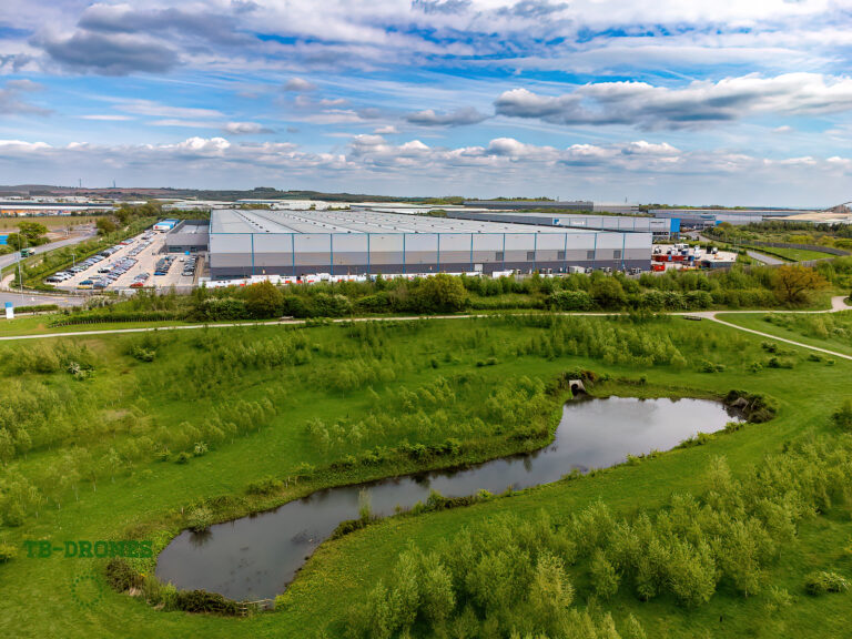
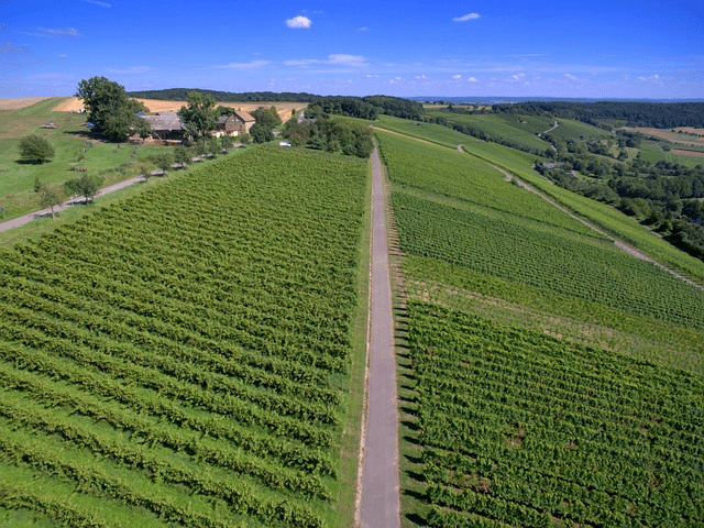
Aerial photography plays a crucial role in urban planning and development. By providing a clear overview of large areas of land, it allows for efficient road planning, real estate management, and land use calculations. Plus, it can help pinpoint exact positions for ground crews executing complicated land initiatives – how amazing is that?
Air Images can also undertake commissions to photograph any subjects of your choice throughout the UK, ensuring that you have current aerial photos for your planning and development needs. With aerial photography at your disposal, envisioning and executing complex projects becomes a much smoother and more efficient process.
Marketing and Presentation with Aerial Photos

Aerial photography can dynamically promote businesses like resorts, roofing companies, and real estate, providing a stunningly unique perspective of a property. Used in commercial advertising, aerial photos can capture the attention of potential clients, showcasing your business in a way that sets it apart from the competition.
With a range of marketing and presentation services available for aerial photos, the possibilities are endless. From exhibition prints and framed aerial views to customizable promotional products and gifts, these awe-inspiring images can be the key to unlocking your business’ full potential.
Navigating Aerial Photography Collections

Navigating aerial photography collections may seem daunting, but by searching for date flown and meta data, as well as maps and imagery, you can access millions of images and uncover hidden gems. These collections can be used for regional analysis, evaluating specific sites, and providing invaluable insights into the landscapes and locations they depict.
In the following sections, we will explore the process of searching for aerial photographs through date flown, meta data, and maps. With this knowledge, you will be able to navigate the vast world of aerial photography collections with ease and confidence.
Date Flown and Meta Data
The thrilling date flown in aerial photography refers to the date when the aerial photograph was taken. This information is incredibly exciting because it helps to identify the age of the aerial photograph and can be used to compare different aerial photographs taken at different times.
Meta data is equally exciting information about the aerial photograph, such as the location, altitude, and camera settings used to take the photograph. It helps to identify the conditions under which the aerial photograph was taken, which can be used to compare different aerial photographs taken under different conditions.
By understanding and utilizing date flown and meta data, you can unlock the full potential of aerial photography collections.
Maps and Imagery

Maps play a vital role in aerial photography, providing a reference for the location and orientation of aerial photographs and creating accurate mapping of land cover and landscape features. The most exciting types of maps used in aerial photography are topographic maps, orthophotos, and digital elevation models. These maps are essential for understanding the context of aerial photographs and accurately interpreting the features and patterns visible in the images.
Using maps in aerial photography can help identify features and patterns that may not be visible to the naked eye, and provide a more accurate representation of the landscape. By incorporating maps and imagery into your aerial photography research, you can gain a deeper understanding of the landscapes and locations depicted in the photographs.
Capturing Aerial Images

Capturing aerial images requires choosing the right camera and techniques, as well as following safety and regulations. In this section, we will explore the various camera choices available for aerial photography, the techniques for capturing stunning aerial photos, and the importance of adhering to safety regulations.
From DSLRs and mirrorless cameras to drones, the options are vast and varied, ensuring that you can find the perfect camera for your aerial photography needs. With the right techniques and an understanding of safety regulations, you can capture awe-inspiring aerial images that will leave a lasting impression.
Camera Choices
Aerial photography can be done with a variety of cameras, including DSLRs, mirrorless cameras, and drones. The type of camera used depends on the purpose of the photos, with options like the DJI Mavic 3 Pro and DJI Air 2S being great choices for aerial photography. For high-resolution images, a DSLR camera with a long-range lens, such as the Canon EF 16-35mm f/2.8L III USM or Canon EF 70-200mm f/2.8L IS III USM, is recommended.
In addition to selecting the right camera, it’s important to use a fast shutter speed to ensure sharp and clear images. A minimum shutter speed of 1/500 s or faster is suggested, allowing you to freeze any movement in the scene and capture stunning aerial images.
Techniques for Capturing Stunning Aerial Photos
One awesome technique for capturing aerial photos is to use camera drones, which provide a unique perspective and allow photographers to capture stunning images from angles and heights that would otherwise be impossible. They also offer a greater degree of control and flexibility, allowing photographers to adjust the camera settings and position quickly and easily.
When capturing aerial photos, it’s important to consider the angle of the shot, the lighting, and the composition of the image. Look for patterns and symmetry in the landscape, and use a fast shutter speed to reduce motion blur and ensure a sharp, clear image. With the right techniques, you can create breathtaking aerial photos that showcase the beauty of our world.
Aerial Photography Safety and Regulations
When capturing aerial photos, it is crucial to follow all applicable safety and regulations, including obtaining the necessary permits, following airspace regulations, and adhering to any local laws. Additionally, it is important to ensure that the aircraft and equipment used are in good working order and that the pilot is properly trained and certified.
In the UK, aerial photography regulations require drones to be operated at least 50 meters away from any person, building, vehicle, or structure at all times, and drones weighing 250 grams or more must be operated at least 150 meters away from parks, industrial areas, residential zones, and other built-up locations.
By adhering to these safety regulations and guidelines, you can capture stunning aerial images while ensuring the safety of those around you.
Inspiring Aerial Photography Projects

Throughout the years, aerial photography has been used to document historic events, monitor environmental changes, and create awe-inspiring artistic projects. In this section, we will explore inspiring examples of aerial photography projects that showcase the versatility and power of this art form.
From capturing the aftermath of the 9/11 attacks in New York City to monitoring deforestation and tracking wildlife, aerial photography has made a significant impact on our understanding of the world around us. Let’s take a closer look at some of these inspiring projects.
Documenting Historic Events

Aerial photography has played a pivotal role in documenting historic events, providing a wider perspective and capturing images that are difficult or impossible to see on the ground. In addition to its use in documenting disasters like the 9/11 attacks, aerial photography has also proven invaluable in archaeological studies, helping to identify and map sites, monitor changes in the landscape, and detect subtle features that may not be obvious on the ground.
By examining historic aerial photographs, we can gain a deeper understanding of the events that have shaped our world and trace the development and transformation of cities, towns, and landscapes throughout history.
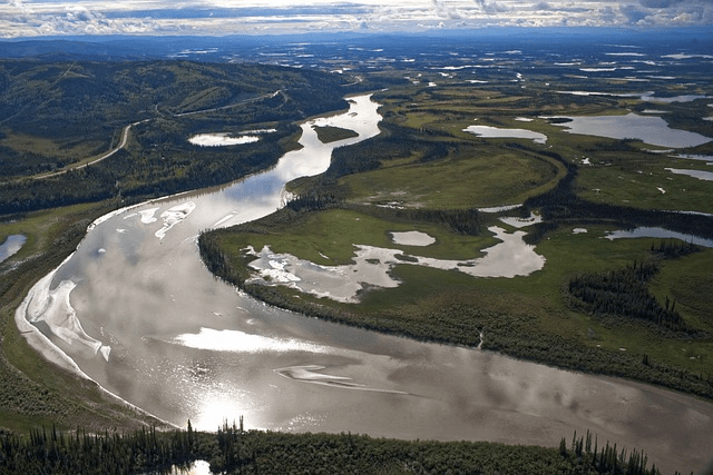
Environmental Monitoring and Conservation
Aerial photography has been an essential tool in environmental monitoring and conservation efforts, providing detailed views of the landscape and allowing for efficient mapping, inventorying, and planning. By identifying areas of pollution and habitat destruction, aerial photography can help pinpoint areas in need of conservation and protection.
Aerial photography can also be used to monitor changes in land use, vegetation cover, and water bodies, providing valuable information for environmental analysis and decision-making. From tracking deforestation to studying the effects of climate change, aerial photography has made a significant impact on our ability to monitor and protect the environment.
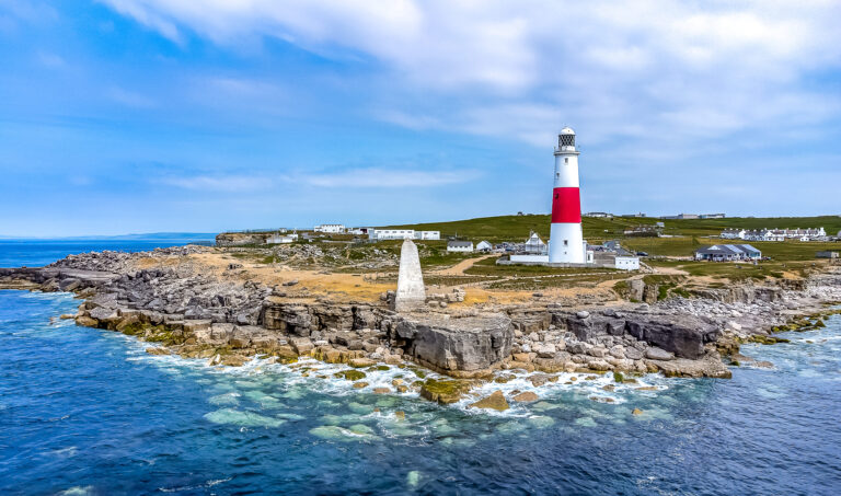
Artistic and Creative Aerial Projects
Aerial photography has opened up a world of artistic and creative possibilities, allowing photographers to capture landscapes and cityscapes from a unique, exciting perspective. This innovative approach has led to the creation of stunning works of art that showcase the beauty of our world from a fresh angle.
By utilizing drones and other aerial photography techniques, artists can capture images of large areas that would be difficult to capture from the ground, providing a new and innovative way to depict abstract landscapes and urban scenes. The captivating visuals produced by artistic aerial projects serve as a testament to the power and versatility of aerial photography.
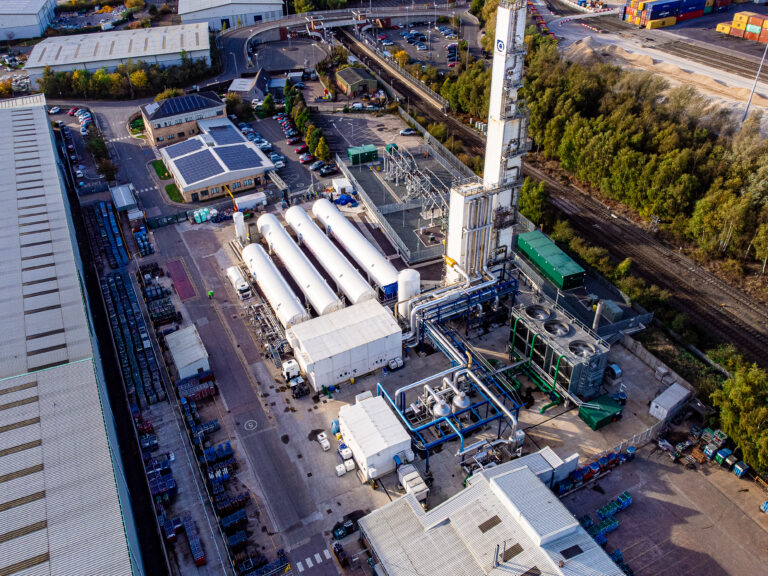
Commercial Aerial Photography
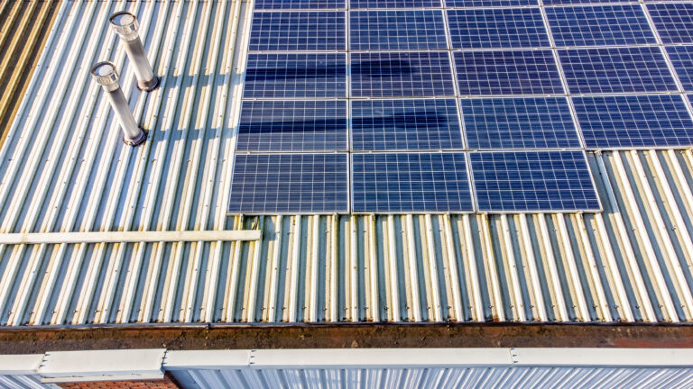
In the world of business, aerial photography has found a multitude of commercial applications, from real estate photography and construction site monitoring to aerial mapping and advertising. The unique perspective provided by aerial photography can create stunning visuals for marketing materials, setting businesses apart from their competition.
The advantages of using aerial photography in commercial projects are many, including cost savings, improved accuracy, increased safety, and the ability to capture images from difficult-to-reach locations. Whether showcasing a property from a bird’s eye view or monitoring the progress of a construction project, commercial aerial photography has transformed the way businesses operate and present themselves to the world.
Summary
From its historic applications to its creative and commercial uses, aerial photography has proven to be a powerful and versatile tool that has captured the imagination of artists, researchers, and businesses alike. As we’ve explored in this blog post, aerial photography offers a unique perspective on the world around us, providing invaluable insights into landscapes, cityscapes, and the environment. With the right equipment, techniques, and adherence to safety regulations, aerial photography can unlock a world of possibilities, allowing us to see our world from a whole new angle. So why not take to the skies and discover the magic of aerial photography for yourself?
Frequently Asked Questions
How can I take aerial photos?
To take great aerial photos, you can get a drone with a built-in camera or use an action camera. Make sure to fly in a clear area with no obstacles and adjust settings for shutter speed, ISO, and aperture.
Secure your camera gear, keep the windows clean, and wear dark clothing to capture the best shots. With some practice, you’ll be taking stunning aerial photos!
What does aerial photography do?
Excitingly, aerial photography provides a birds-eye view of the world and helps us understand our landscapes from a perspective we could never get from the ground. From urban planning and land use analysis to wildlife and habitat management, it has become an invaluable tool for recording and understanding changes over time.
How to find old aerial photos?
Ready to uncover the history beneath your feet? Find old aerial photos by taking advantage of the many services available, such as Google Earth Pro, Esri’s Wayback Living Atlas, USGS LandLook, NASA Worldview and Planet Labs.
So get out there and explore the historical imagery of our planet!

Tony Bryan is a professional aerial photographer and drone operator based in the Midlands of the UK. With a passion for capturing stunning aerial footage, Tony founded TB Drones, a company that specializes in drone photography and videography services for a variety of industries, including real estate, construction, and events. With years of experience in the field, Tony has become an expert in using drones to capture breathtaking aerial footage that provides a unique perspective on the world around us. Whether he’s working on a commercial project or capturing stunning landscape photography, Tony is committed to providing his clients with exceptional service and beautiful results.